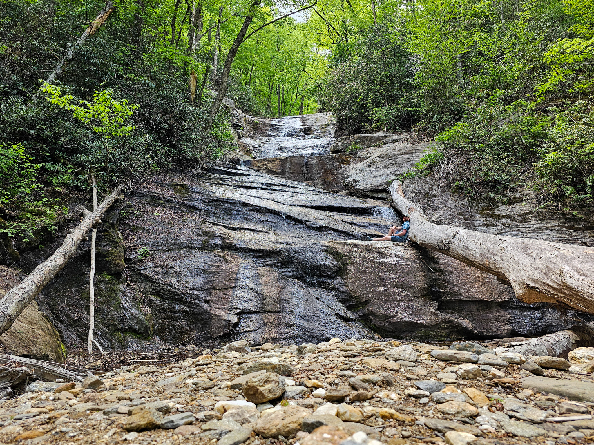
Lower Sam Branch Falls is a majestic, 20-foot waterfall located off of NC-215 in the Pisgah National Forest along Sam Branch. While there is no official Google Maps location, the trailhead can be found at 35.3394° N, 82.9009° W on the south end of the outer guard rail. This is the same trailhead for Wash Hollow Falls and Sam Branch Falls. From here, you'll see a steep path ascending up the mountain as shown below.
Trailhead for Lower Sam Branch Falls, Wash Hollow Falls, and Sam Branch Falls.
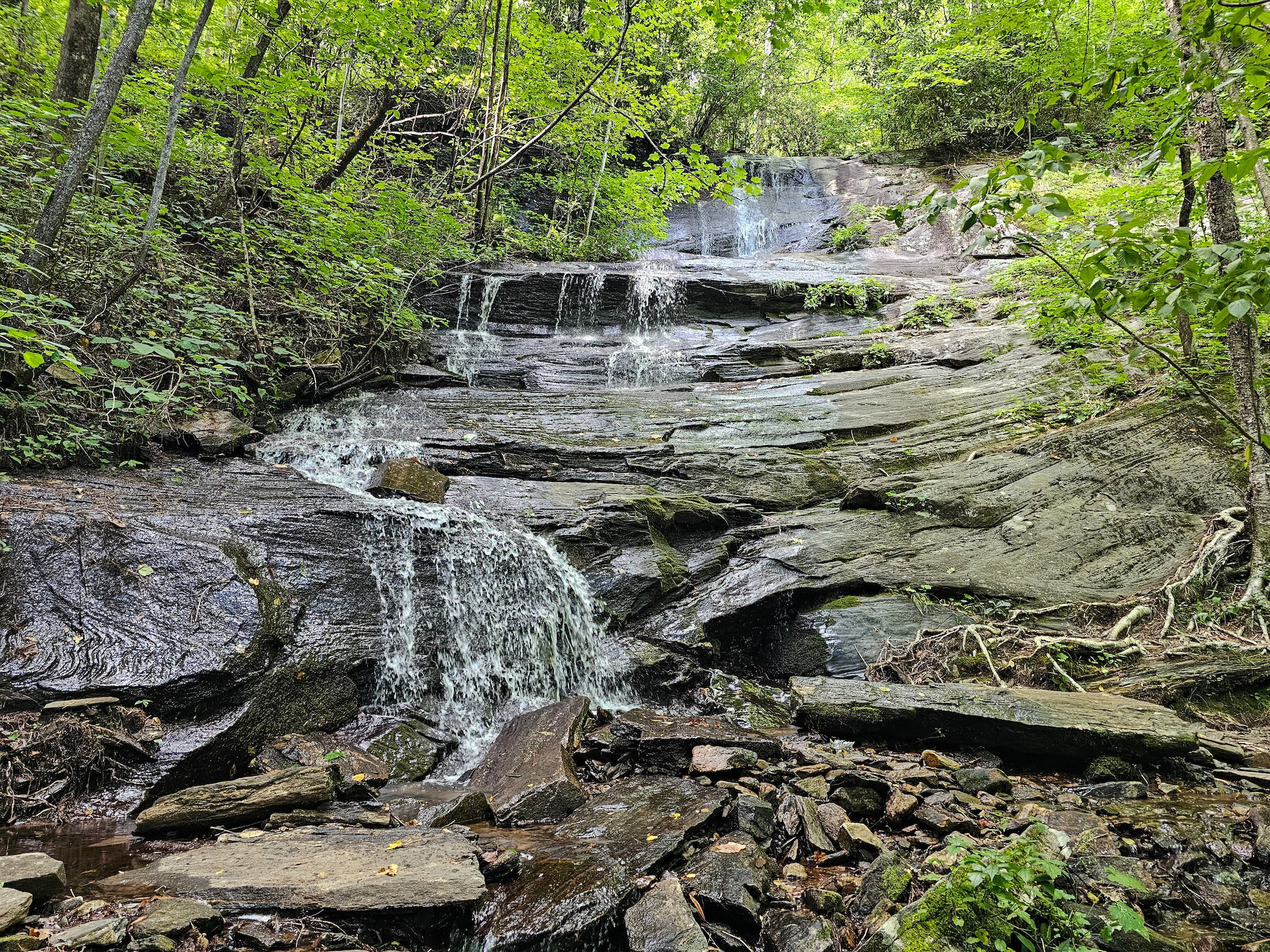
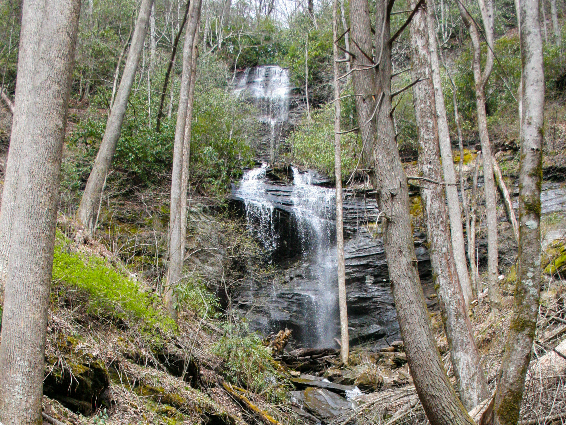
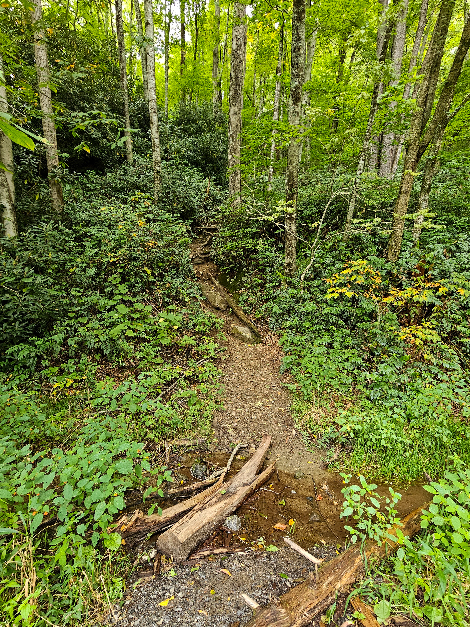
From the trailhead continue for about 0.2 miles through the overgrown underbrush until you come to a fork near what looks like a dried up waterfall. You can see this in the image below. This feature is actually the result of a rockslide from Hurricane Helene in 2024. There will appear to be a trail that continues straight parallel to the rockslide, but you'll also find a trail on the left that leads down towards the creek bed. Take the left trail towards the creek you see on the left side of the image below.
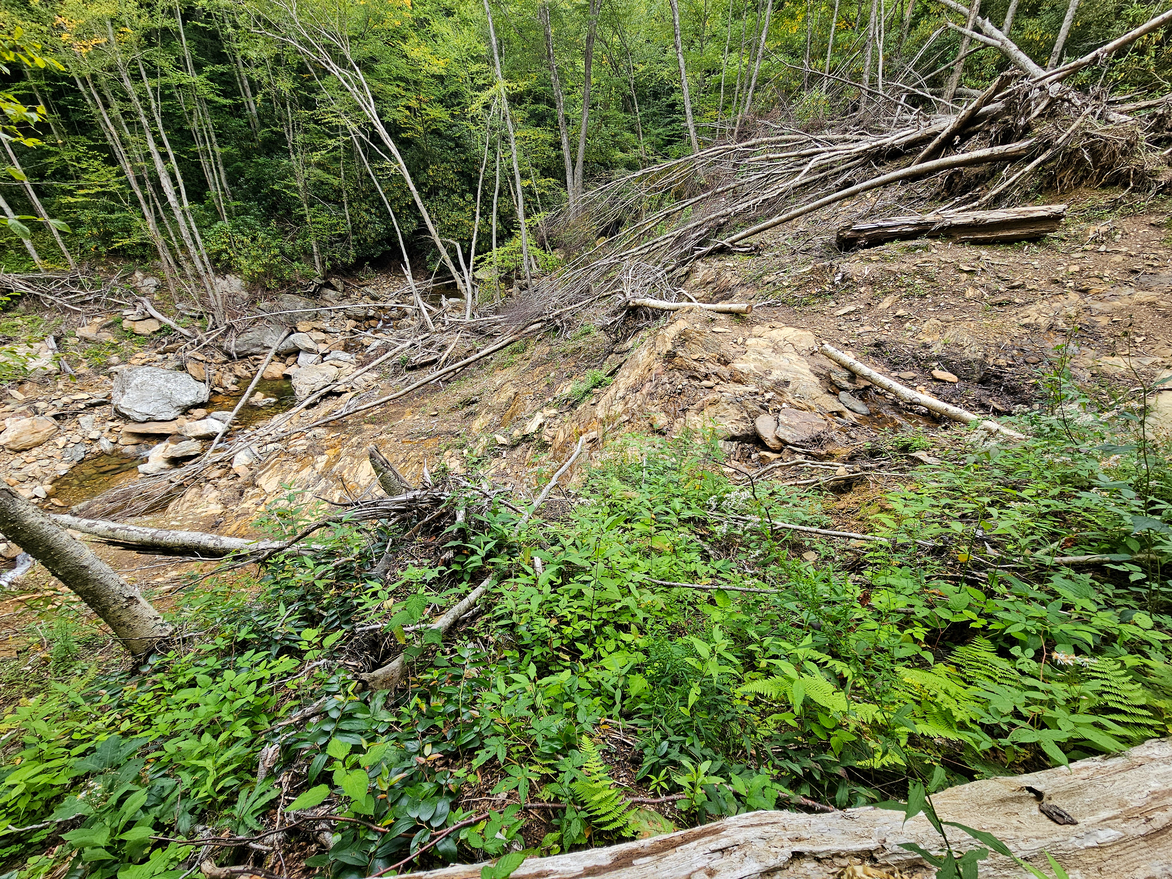
Rockslide wreckage from Hurricane Helene in 2024.
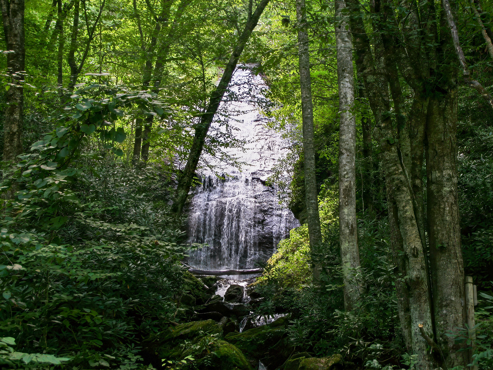
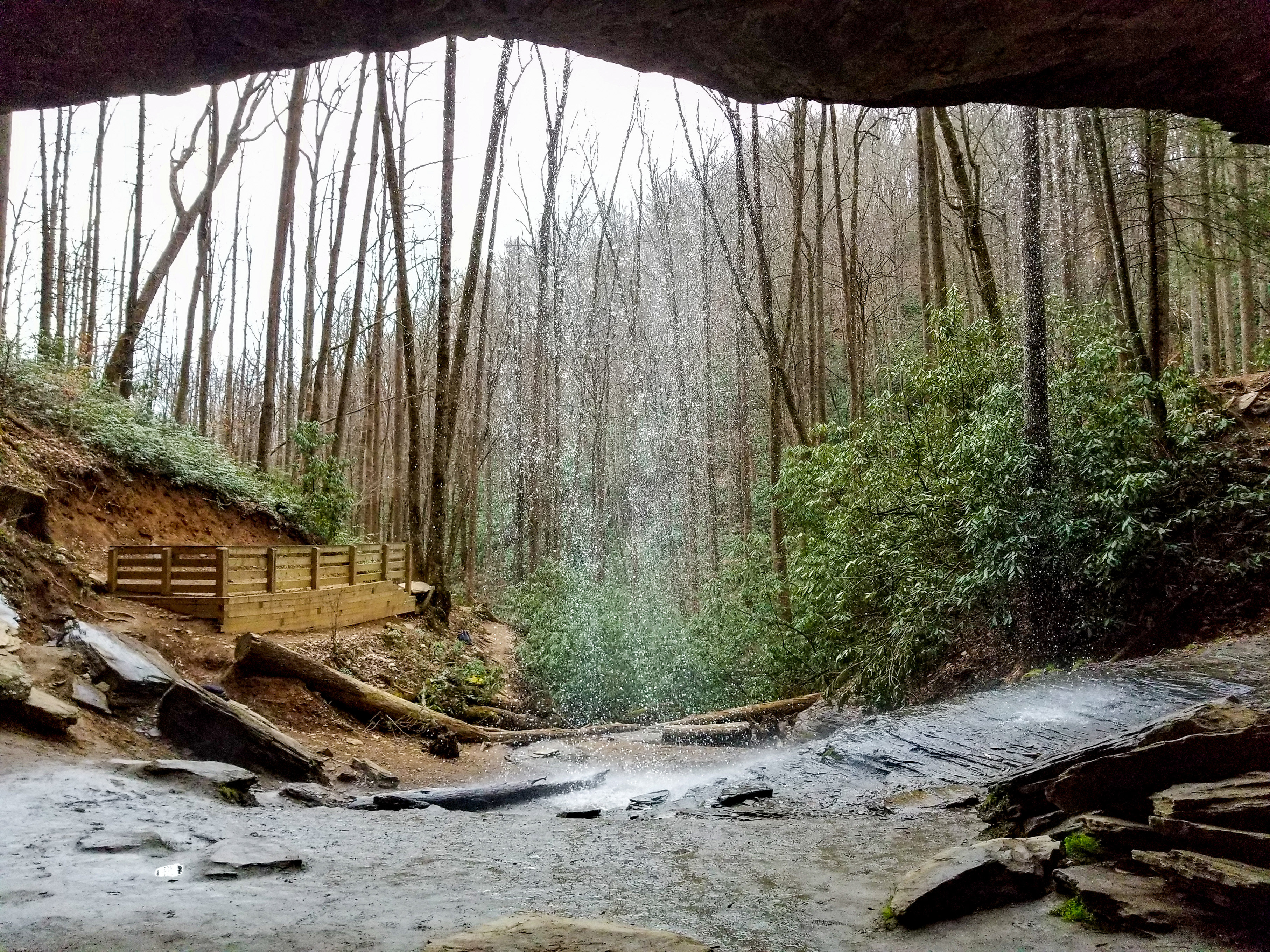
From the creek bed, the rockslide will be on your right, while the creek will be on your left. Follow the creek until Lower Sam Branch Falls comes into view at about 0.3 miles in. Enjoy!
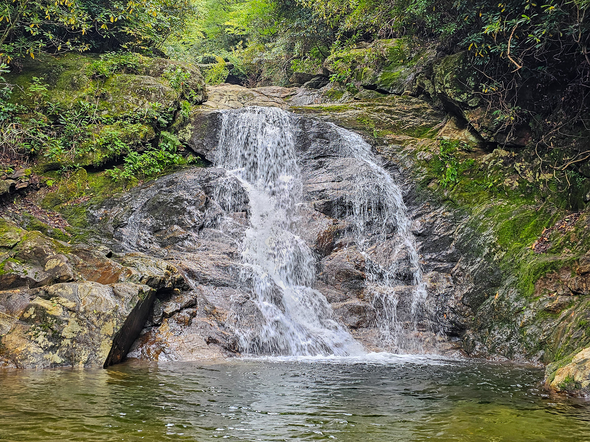
Lower Sam Branch Falls.
This hike can be extended another 0.2 miles to see Wash Hollow Falls, 1 mile to see Sam Branch Falls, or 1.2 miles to see both.
Parking Location: 35.3396° N, 82.9012° W
GPS Location: 35.3411° N, 82.8982° W
Parking: Roadside Pull-off
Total Hike: 0.7 miles
Wheelchair Accessible: No
Admission: Free
Open: 24/7
Swimming: Yes
Pets: Yes, with leash
GPS Location: 35.3411° N, 82.8982° W
Parking: Roadside Pull-off
Total Hike: 0.7 miles
Wheelchair Accessible: No
Admission: Free
Open: 24/7
Swimming: Yes
Pets: Yes, with leash